Bombogenesis – What Is It?
Ready or not, we have the potential for another major snowstorm on Thursday, and meteorologists are throwing around the term "Bombogenesis". What is bombogenesis? In short, it means the potential of a crap ton of snow!
According to Weather.com
To be classified as a weather bomb, or having undergone bombogenesis or "bombing-out", the central pressure of a low pressure system must drop at least 24 millibars within 24 hours. Bombogenesis results when there is a large temperature gradient, usually between a cold continental air mass and warm sea-surface temperatures. However, it can also be the product of a cold polar air mass and much warmer air from the south, say, over the Plains states. Over that temperature contrast, a powerful, intensifying jet-stream disturbance triggers air to rise and kicking off the bombogenesis process.
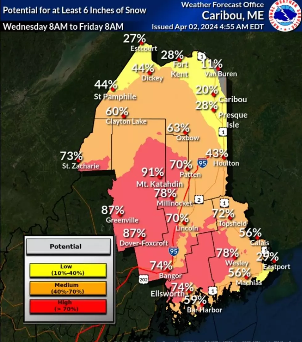
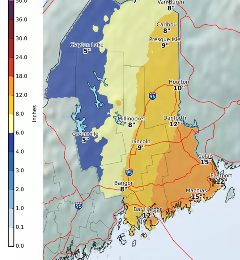
That being said, here's the graphic from the National Weather Service in Caribou for potential snowfall on Thursday into Friday!
More From WDEA Ellsworth Maine